Big data & AI in Geosciences (地球科学大数据与人工智能)Fall, 2021-present, open for all graduate students at USTC Main instructor: Xinming Wu TAs of 2023: Chuanli Dai and Zhixiang Guo TAs of 2022: Hang Gao and Hui Gao TAs of 2021: Xu Si and Zhengfa Bi |
|||||
|
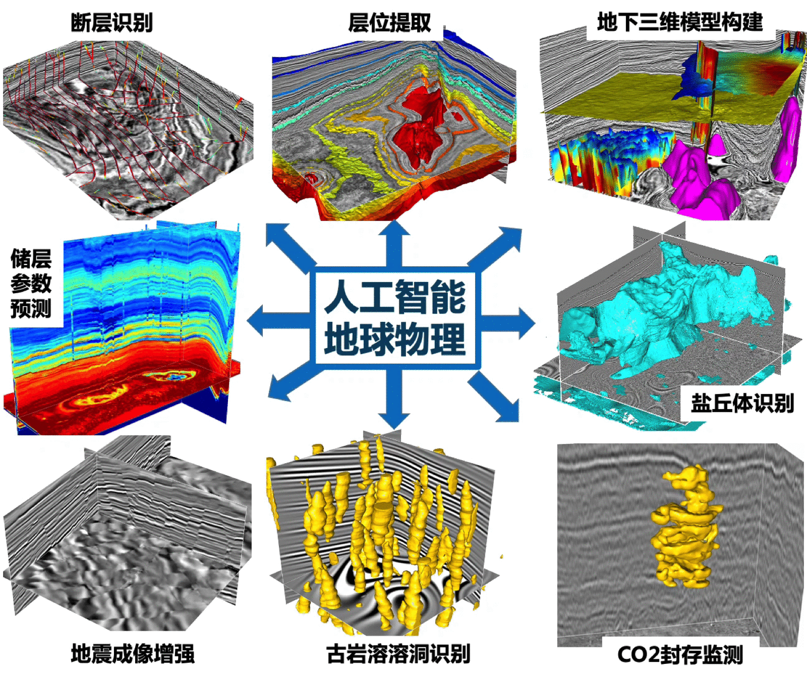
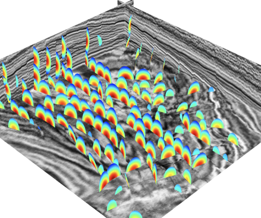
In this course, we introduce the basic concepts of artificial intelligence (AI) and its applications in Geosciences. The course coves 1) mathematic fundamentals of neural networks; 2) AI software platforms (Python, Jupyter, Tensorflow/Keras, pyTorch); 3) geoscience data and their visualization (1D, 2D & 3D) with Python; 4) basic components and principles of artificial neural networks; 5) aspects of training neural networks (e.g., loss functions, optimization methods, backpropagation, data augmentation); 6) commonly used CNNs (e.g., AlexNet, VGG, GoogLeNet, ResNet, GAN); 7) latest deep neural networks; 8) deep learning based case studies in geoscience. Based on the studying of the above topics, students are expected to be able to independently design proper neural networks for their specific geoscience problems, prepare training datasets, properly train the networks, and further validate and apply the trained networks. [Pho.2021-2] [Pho.2021-1] | ||||
Artificial Intelligence in Geosciences (人工智能地球科学)Main instructors: Xinming Wu Fall, 2023, will be open for all geophysics undergraduates at USTC Fall, 2020-2021, open for all undergraduate students at USTC Thanks to Huawei Cloud for granting our students free computational resources to work on their homework/final projects. |
|||||
|
In this course, we learn the basic concepts of artificial intelligence (AI) and its applications in Geosciences. The course coves 1) mathematic fundamentals of neural networks; 2) AI software platforms (Python, Jupyter, Tensorflow/Keras, cloud computing); 3) classic machine learning classifiers; 4) basic components and principles of artificial neural networks; 5) aspects of training neural networks (e.g., loss functions, optimization methods, backpropagation, data augmentation); 6) commonly used convolutional neural networks (e.g., AlexNet, VGG, GoogLeNet, ResNet, GAN). Based on the studying of the above topics, students are expected to be able to independently design proper neural networks for their specific geoscience problems, prepare training datasets, properly train the networks, and further validate and apply the trained networks. | ||||
|
Lecture 00: Brief history of AI Lecture 01: Introduction to Python Lecture 02: Jupyter Notebook, Numpy & Matplotlib [slides] Lecture 03: Linear neural networks: linear regression, loss, GD, SGD Lecture 04: Linear neural networks: softmax regression, loss, GD, SGD Lecture 05: Multi-layer perceptrons, active function Lecture 06: Neural networks (recap), back propagation Lecture 07: AI in seismology, 李泽峰,特任研究员 Lecture 08: Back propagation(recap), deep learning frameworks Lecture 09: AI, Cloud computing, & Huawei ModelArts, 华为全栈全场景AI, 陈亮, 华为云AI首席技术布道师 Lecture 10: CNNs (convolution, pooling, LeNet-5, AlexNet, VGGNet, GoogleNet, ResNet) Lecture 11: Segmentation (upsampling, skip-connections, FCN, Encoder-Decoder, SegNet, Unet, DeepLab) Lecture 12: Recurrent neural networks, LSTM, back propagation recap Lecture 13: Attention in deep learning, transformer, VIT Lecture 14: AI in geoscience Lecture 15: Final project, seismic fault segmentation challenge, submit through Huawei Cloud |
|||||
| TAs for Artificial Intelligence in Geosciences, 2020 Fall | ||||||
| Xu created the final project of seismic fault segmentation challenge on the Huawei Cloud and Kaggle. In this project, we consider fault detection in seismic images as a binary segmentation problem. All the students are free to design any convolutional neural network (CNN) to achieve the fault segmentation in seismic images. We provide 2000 training dataset pairs of 2D seismic images and the corresponding binary fault labels. All the students are supported by Huawei Cloud where they can train their CNN models and make predictions on 200 validation images. All students will need to upload their prediction results to http://www.kaggle.com/c/ustc-geo-ai20 and the results (and students) will be automatically scored and ranked. Everyone is encouraged to keep updating his/her CNN model and uploading new predictions to improve the score. Thanks to Huawei for supporting the computational sources. | ||||||
| TAs for Artificial Intelligence in Geosciences, 2021 Fall | ||||||
| Jintao created the final project of rock image classification challenge on the Kaggle. All the students are free to design any convolutional neural network (CNN) to achieve the task of rock image identification. Thanks to Xing Tan, Chang Ding and Wenkai Xuan for providing thousands of training dataset pairs of 2D rock images and the corresponding labels of 32 rock types. Our students are supported by the USTC computing resource: http://etcis-ai.ustc.edu.cn/landing to train their networks and make predictions. All students will need to upload their prediction results to https://www.kaggle.com/c/ustc-geo-ai21/ and the results (and students) will be automatically scored and ranked. Everyone is encouraged to keep updating his/her CNN model and uploading new predictions to improve the score. | ||||||